A Member State of the United Nations may provide maps of its sovereign territory to the Organization for archiving and circulation purposes.
Moreover, the maps provided by the states do not necessarily comply with the instructions set out in the UN Guidelines for the Publication of Maps, as they refer exclusively to the maps processed by the Secretariat of the Organization online and on other media.
In fact, at the request of a UN member state, any map presenting country’s own ideas about its sovereign territory can be circulated, which does not imply official approval and acceptance by the UN.
The Fact Investigation Platform studied the maps from different years provided to the UN since Armenia declared independence.
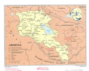
Map of 1996: Nagorno Karabakh is there
The first available map put into circulation at the United Nations was provided by the Republic of Armenia during the tenure of the first president, Levon Ter-Petrosyan, in 1996.
The map contains Nagorno Karabakh, although not as part of the sovereign territory of the Republic of Armenia and with Azerbaijani place names. For instance, Stepanakert is mentioned as Khankendi.
The two so-called enclaves not included in the sovereign territory of the Republic of Armenia can be seen in the Tavush Province.
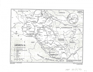
Map of 1997: Armenian place names appear in the Nagorno Karabakh section
The next map provided by the Republic of Armenia during the presidency of Ter-Petrosyan was put into circulation in the UN in November 1997.
This map slightly differs from the previous one: in the Nagorno-Karabakh section, the Armenian place name Stepanakert was added in brackets next to the Azerbaijani place name Khankendi.
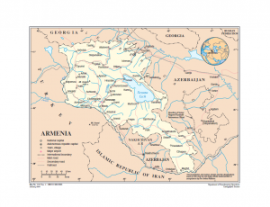
Maps circulated in 2004 do not differ from those provided in 1997
Maps put into circulation during the administration of the second President Robert Kocharyan in January and May 2004 do not differ from the map circulated in 1997, particularly with regard to Nagorno-Karabakh and enclaves in Tavush Province.
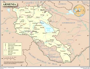
Map of 2008: Tigranashen is mentioned as an enclave while Nagorno Karabakh is absent
In May 2008, during the first term of the third president of the Republic of Armenia, Serzh Sargsyan, a map provided by the Republic of Armenia was put into circulation in the United Nations, in which Nagorno Karabakh is absent for the first time, and the Azerbaijani place name Khankendi is used instead of Stepanakert.
Also for the first time, Tigranashen village of Ararat Province is represented as an enclave not included in the sovereign territory of the Republic of Armenia.
The so-called enclaves of Tavush Province are preserved on the map.
The same map (without Nagorno-Karabakh and with three Azerbaijani enclaves in the sovereign territory of the Republic of Armenia) was also circulated in the UN in 2013, the first year of Sargsyan’s second term as president.
There are no other available maps of the sovereign territory of Armenia provided by the country in the UN archives.
Thus, since declaring independence, the Republic of Armenia has provided different maps to the UN several times. Nagorno Karabakh was indicated as a separate entity in the maps provided from 1996 to 2004 inclusive, while since 2008 it is completely absent from the maps provided by Armenia to the UN.
At the same time, the two so-called enclaves of Tavush Province of Armenia are present in all the maps. The third one, Tigranashen village of Ararat Province, has been on the maps provided by the Republic of Armenia since 2008.
Nane Manasyan

 FACTOMETER

